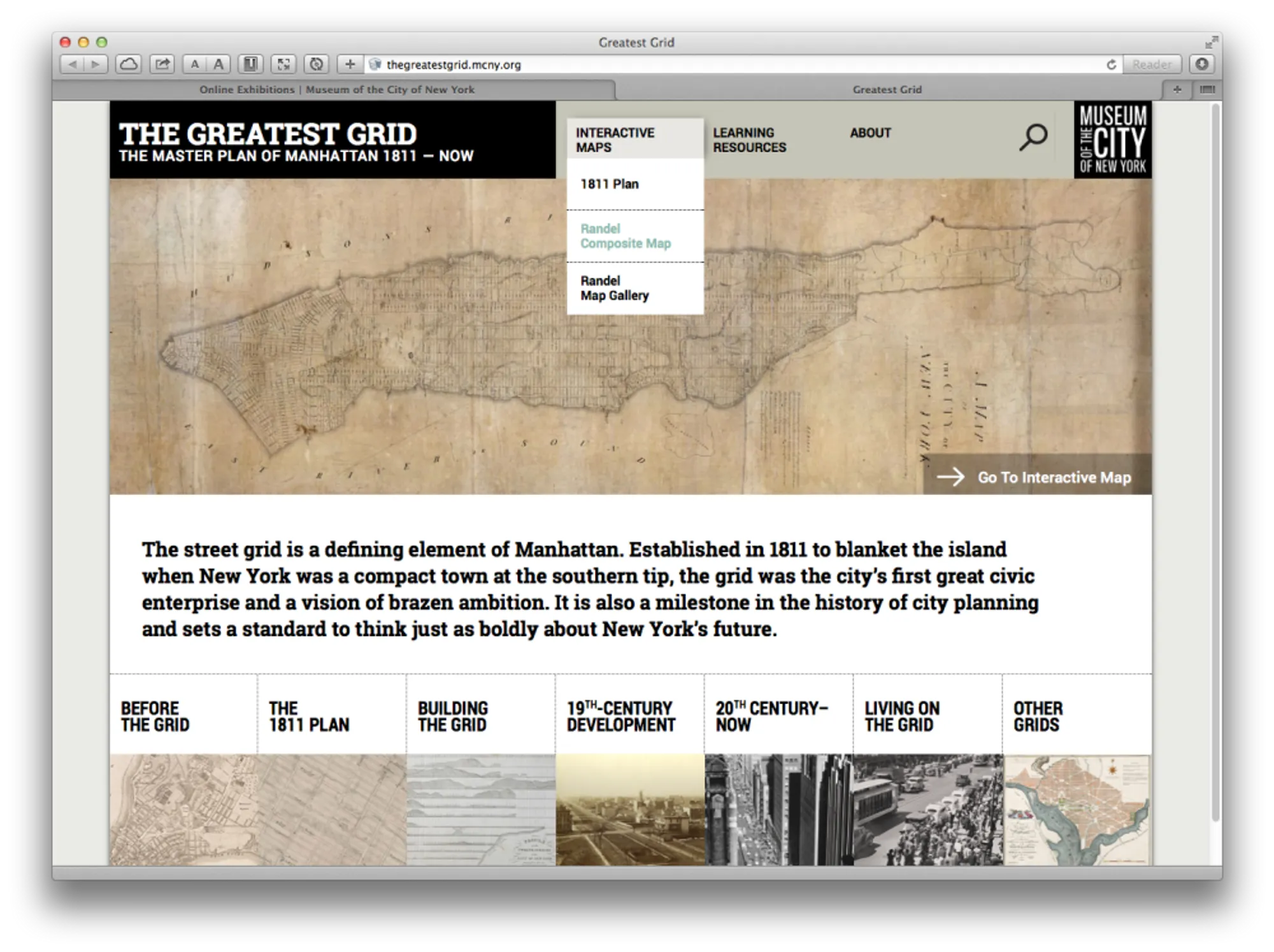
The Greatest Grid
The Master Plan of Manhattan
In collaboration with MediaCombo and the Museum of the City of New York, I designed and developed two interactive historical maps to for an online exhibition about the origin of the grid plan for Manhattan.
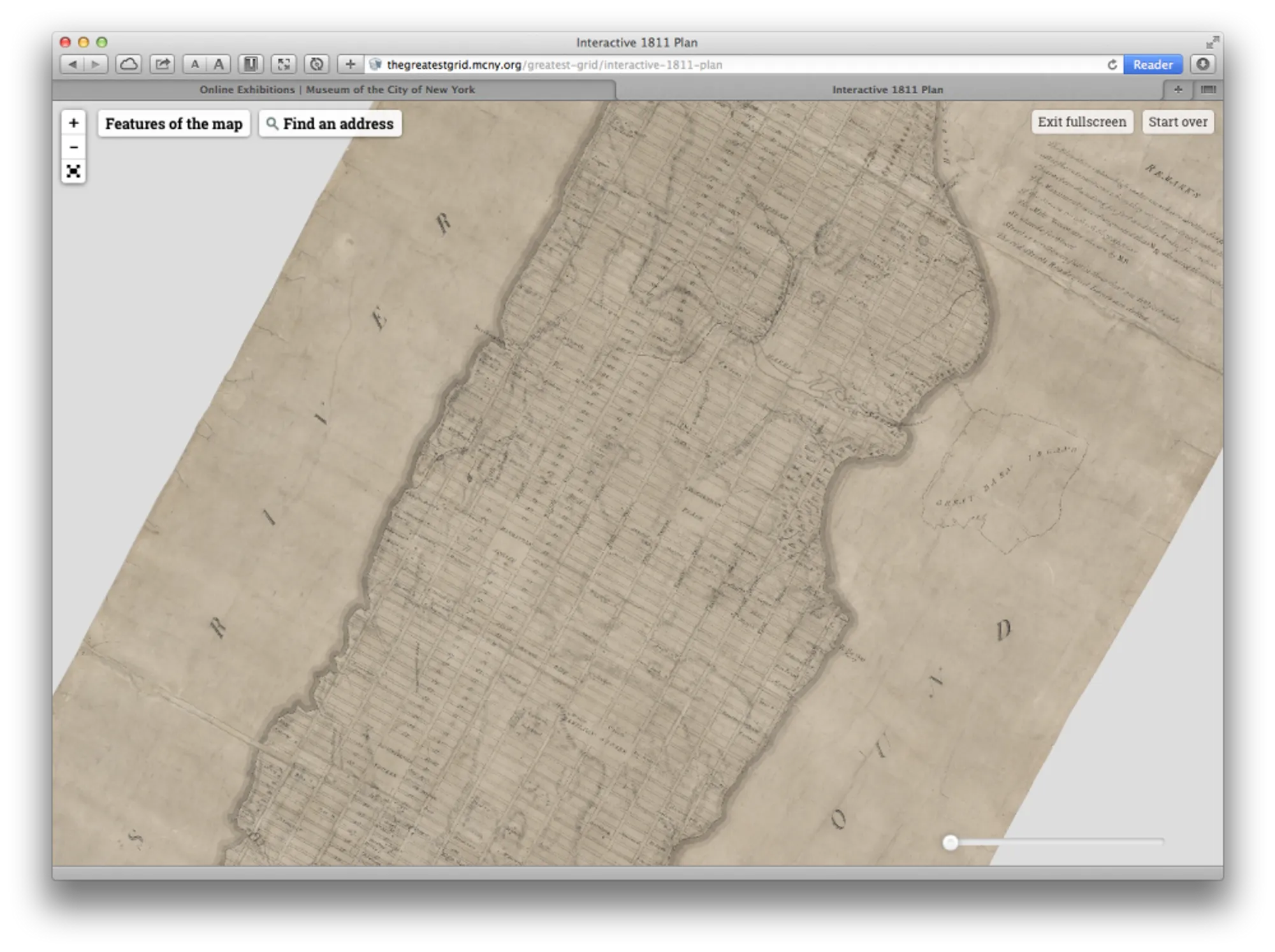
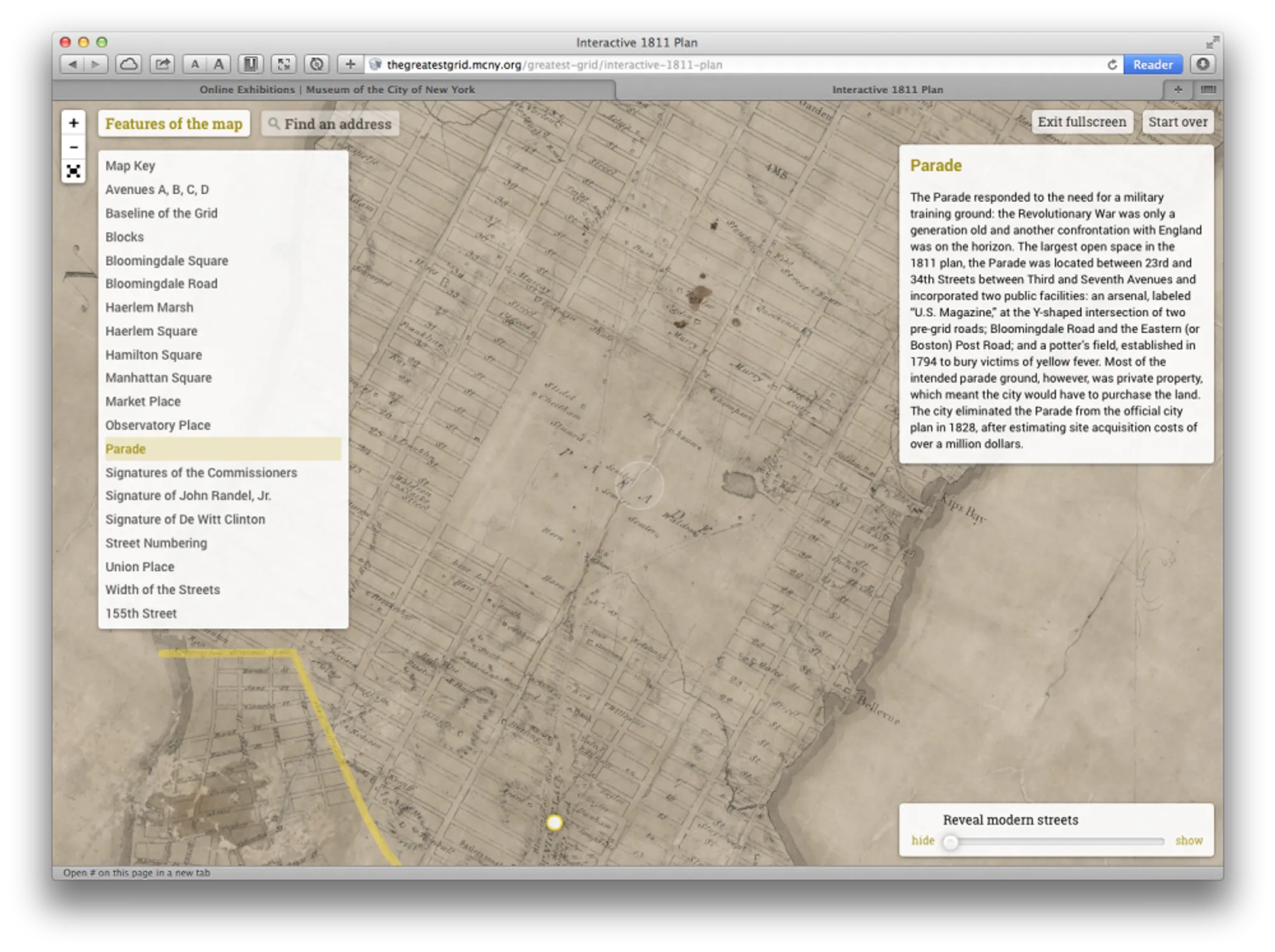
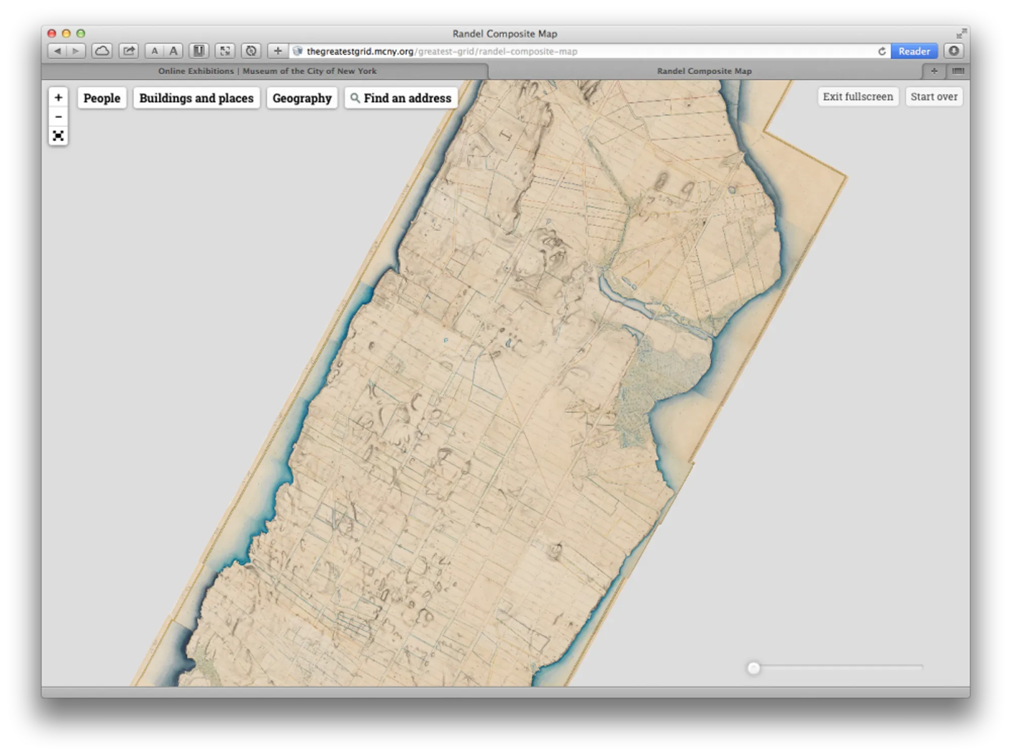
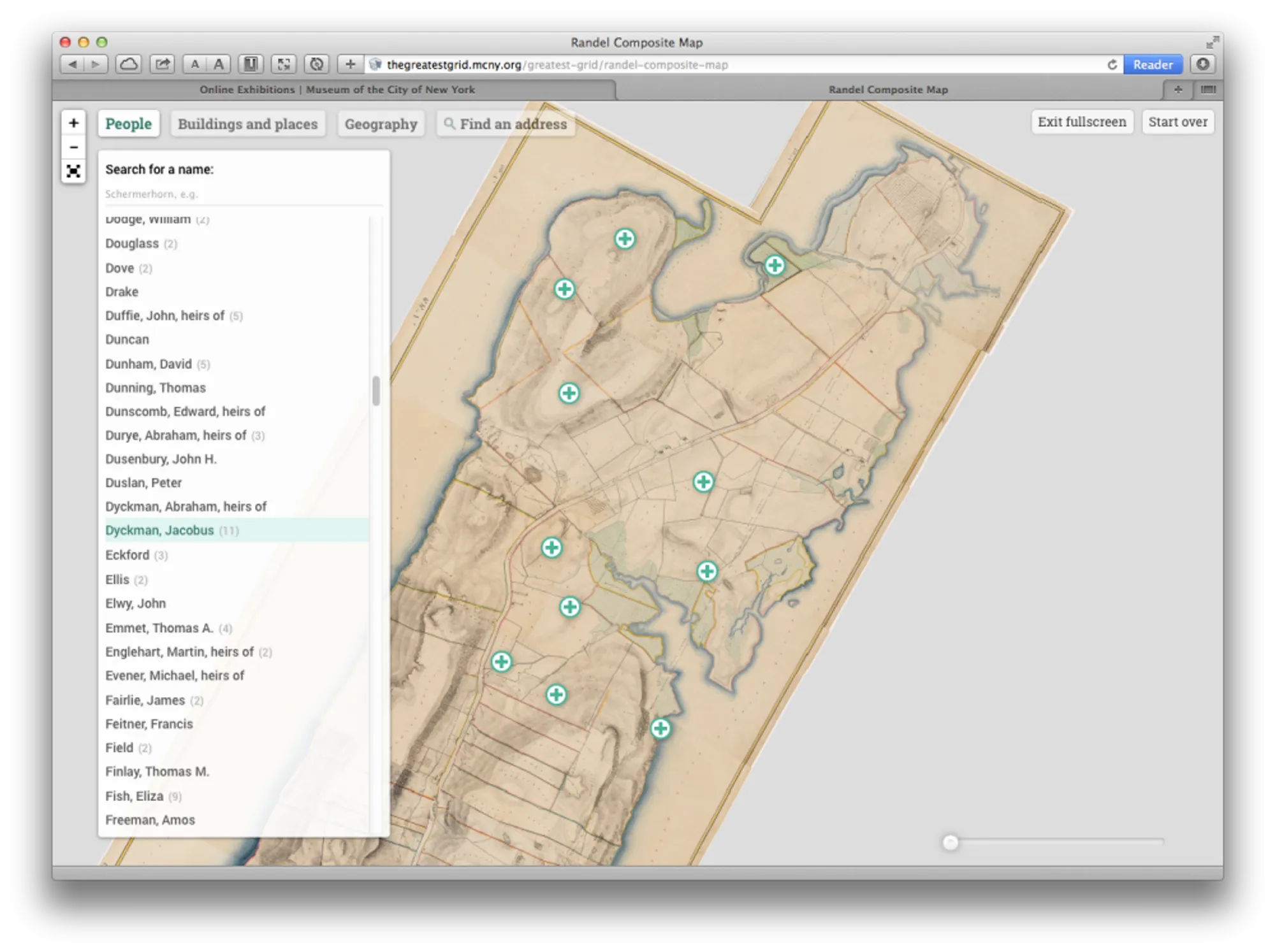
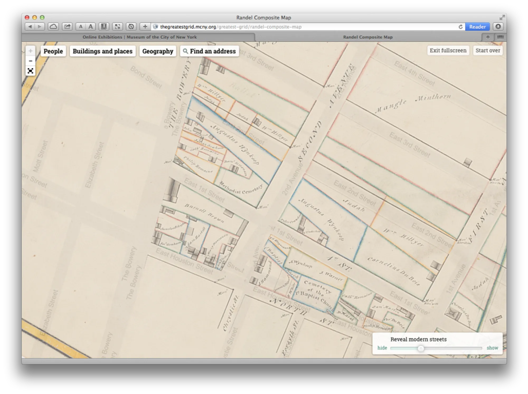
The original 1811 Commissioners' Plan was brought to life with annotations which highlight various aspects of the initial conception of the grid. And the Randel Farm Maps (a 92-volume survey map of Manhattan in the 1810s on the eve of the grid) was composited into a single composite image, from which we indexed and made available every text on the map: landowners, physical features, roads and buildings.
Both maps were georectified, tiled and presented as fully interactive web maps, with the ability to browse, search, zoom and compare against the modern street grid of Manhattan.